|
|
||
|
|
|
 |
|
|
||
|
|
|
|
|
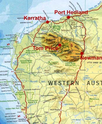
When we traveled North through Newman, we noticed several beautiful pictures of canyons and waterfalls in our hotel. When enquiring, we were told that we would find these places about 200 km to the northwest. In the back of our minds, we were already starting to map out a route for the return trip to Perth to scout the particular areas from the air, so that we could later visit by car. Depending on the wind, it would possibly be only a small detour. We started early in Karratha and flew south toward the Hamersley Range. Navigation was not difficult. We just had to follow the railroad which brings the iron ore down from the mountains and over to the coast. Sometimes these trains are two and a half km long. The flat coastal land was broken up by increasingly higher rock outcrops. Some were rounded while others reminded us of Monument Valley in the USA. Then we came upon the Mountains which displayed a large variation of erosion and rose about 3000 ft. above sea level. Often there were signs of dry creek beds winding down the centers of the valleys. Though no water was visible, the abundance of green vegetation was a clear sign that there must be water. The first sign of accommodation was in Hamersley, a railroad depot with a small dirt airstrip. Besides an array of shiny metal sheds and a multi-purpose building, nothing inviting could be seen from the air. About 15 minutes later we came upon a nice little town with houses surrounded by trees and obviously a pleasant community. Surprisingly, there was no runway to be found. It was the Town of Tom Price. As we crossed the small mountain beside it, we became aware of a gigantic iron ore mine. In spite of being declared a danger area due to possible blasting, we circled overhead, noticing that the hole drilling for the blasting was still in progress and huge trucks were crawling all over. It was just breathtaking to see this immense hole being cut into the ground. With the stair like walls, it was reminiscent of the old Roman Amphitheaters, except that the dimensions were of a far greater scale. From this "Hole" in the ground, we directed our flight west into the mountains. They also showed signs of extensive erosion with rounded tops. However, the most exciting thing were the canyons with carved valleys, separating the smooth high ridges. At many places the cut was so narrow and deep that even the noon day sun could not lighten up the crevasse floor. A canopy of the trees along the canyon edges concealed the fissure. We desperately tried to find a good angle to shoot photos to do justice to this great scenery. Eventually, we had to leave this special place because we had filed a SAR time (search and rescue) and the time was ticking towards our deadline. An hour of flying through no-man's land to Coral Bay was still lie ahead. There was much more to be seen on the ground, especially beautiful erosion patterns or carvings made by rivers that reminded us of a Fractal Pattern. Widely scattered homesteads and a lone Roadhouse finally appeared. We were back among civilization. For those of you who are photo buffs: In the process of adjusting the pictures for the web, some retouching may have made the pictures a bit too pronounced in contrast or color. Some corrections were rather difficult to get just right on our little laptop screen. There was haze, airborne sand, dirty windscreens and their color absorption as well as the high noon sun. Primarily, we attempted to emphasize the structures and as much as possible, some of the details, while not making the picture file too large. If you are interested in any of the pictures to work with, please let us know and we will be happy to send you a copy of the originals. |
|||
 Approaching
from the North, the flat coastal terrain breaks up and has an appearance of a
small scale Monument Valley. Approaching
from the North, the flat coastal terrain breaks up and has an appearance of a
small scale Monument Valley. |
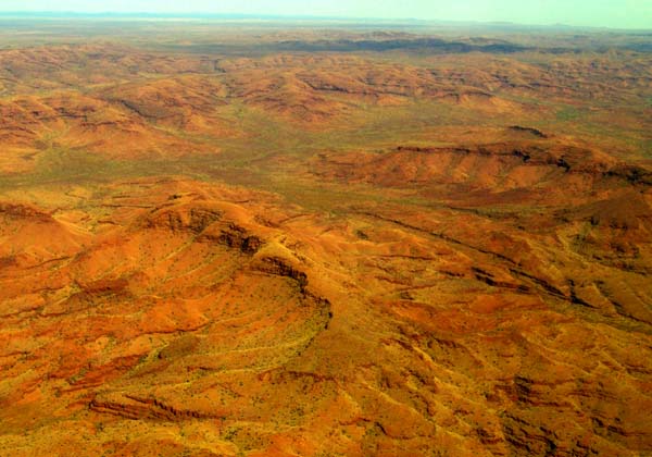 As
the mountains become higher, they take on all shapes created by wind, water and
temperature erosion. The valleys show signs of water. The predominant
color is red from the iron. As
the mountains become higher, they take on all shapes created by wind, water and
temperature erosion. The valleys show signs of water. The predominant
color is red from the iron. |
||
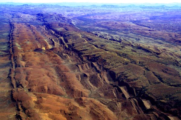
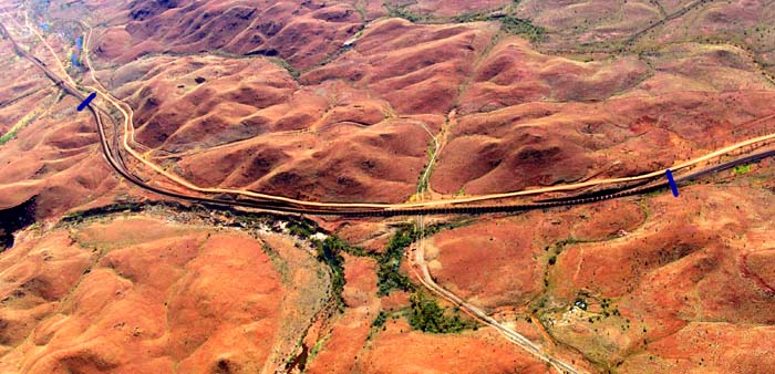 Trains
of 2.5 km length (see blue marks) haul the iron ore to Karratha. Trains
of 2.5 km length (see blue marks) haul the iron ore to Karratha. |
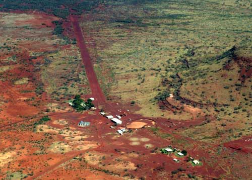 Hamersley,
a forlorn stop along the railroad line. At least it has a landing strip, but
why? Hamersley,
a forlorn stop along the railroad line. At least it has a landing strip, but
why? |
||
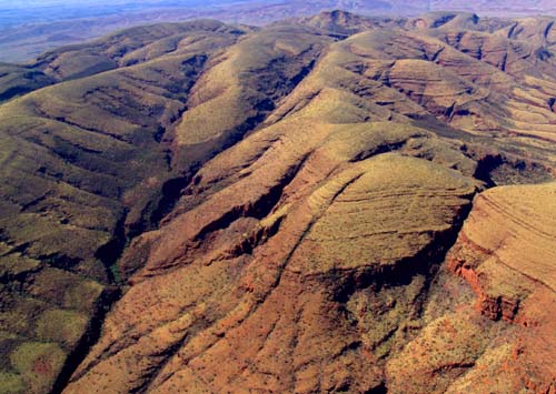
 Most
of the mountains have rounded tops with carvings created by frequent
rain. Most
of the mountains have rounded tops with carvings created by frequent
rain. |
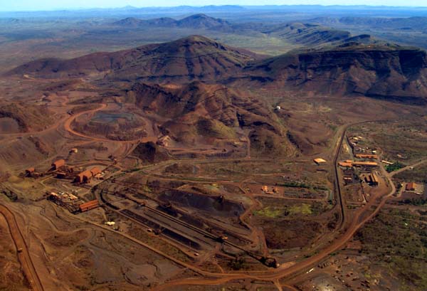
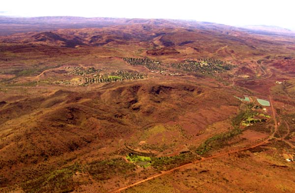 Tom
Price, a nice little mining town bedded between the mountains. Tom
Price, a nice little mining town bedded between the mountains. |
||
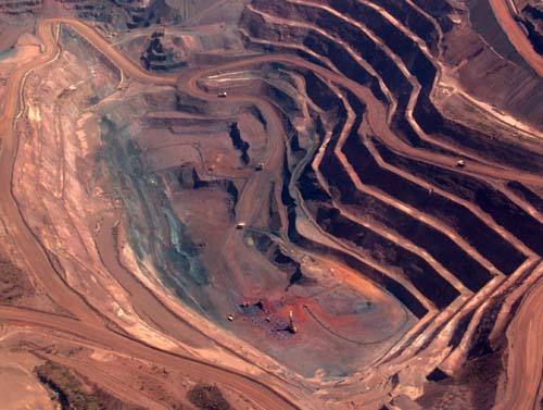
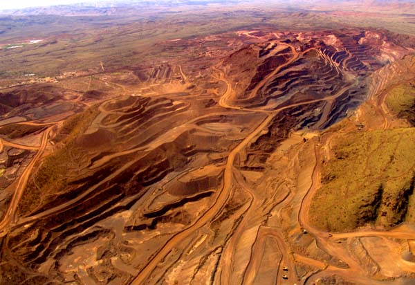 The
mine near Tom Price covers an entire mountain. The
mine near Tom Price covers an entire mountain. |
 View
of the mine from another angle. All rock is shipped to the coastal Town of Karratha, where it is loaded into ocean ships. View
of the mine from another angle. All rock is shipped to the coastal Town of Karratha, where it is loaded into ocean ships. |
||
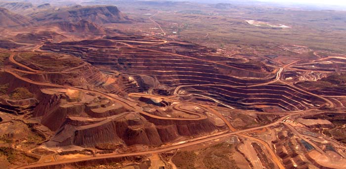
 The
processing and loading side of the mine, where 2.5 km long trains are
linked together. The
processing and loading side of the mine, where 2.5 km long trains are
linked together. |
|
||
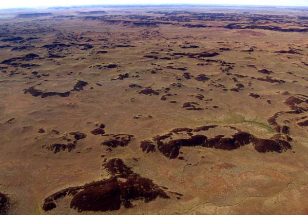
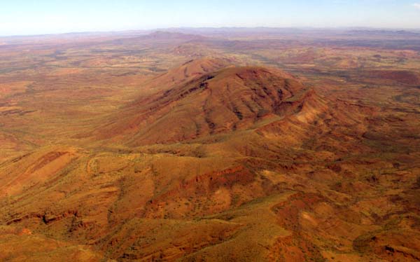
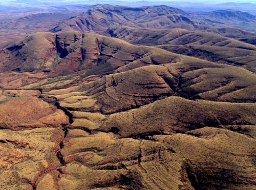 Old
smoothed out mountain ranges with stunning gorges. Old
smoothed out mountain ranges with stunning gorges. |
 No
roads are visible. You wonder whether it is possible to visit these remote
places. No
roads are visible. You wonder whether it is possible to visit these remote
places. |
||
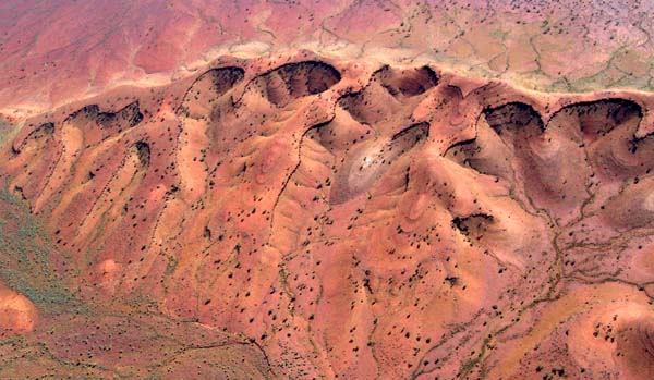 Fascinating
erosion pattern, nature displays itself in the most beautiful ways. Fascinating
erosion pattern, nature displays itself in the most beautiful ways. |
 An
old mountain range is close to disappearing. No people live close by. All is
just for an occasional admirer. An
old mountain range is close to disappearing. No people live close by. All is
just for an occasional admirer. |
||
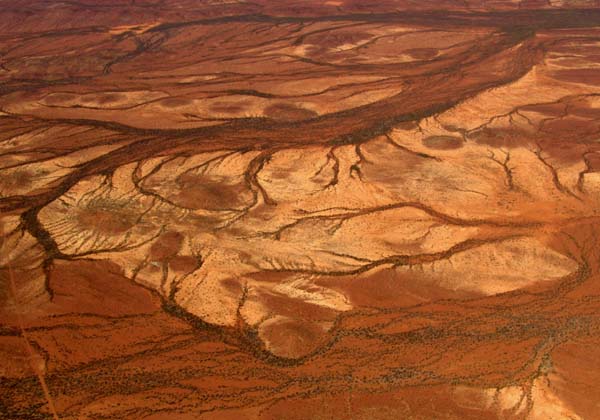 The
sparse rains carve the rivers. When the river beds run dry, they leave
behind beautiful pieces of art. The
sparse rains carve the rivers. When the river beds run dry, they leave
behind beautiful pieces of art. |
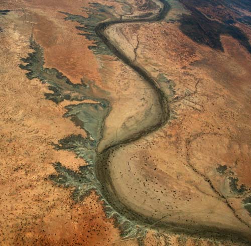 Nature
adds the color of green to emphasize the delicate structures. These
tributaries to the main river bed reminds one of the pattern created by the
Fractals so popular a few years back. Nature
adds the color of green to emphasize the delicate structures. These
tributaries to the main river bed reminds one of the pattern created by the
Fractals so popular a few years back. |
||
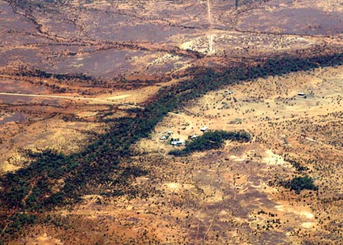 If
you wait long enough, a lonely homestead appears, reminding you that you may
not be all alone, just in case help is needed. If
you wait long enough, a lonely homestead appears, reminding you that you may
not be all alone, just in case help is needed. |
Don't hesitate to give us your impressions. You can contact us via wefly4fun2@aol.com
|
||
|
This page was last modified on 29. April 2005 |
|||